

Lamberton Hill [Ayton Hill]
Good walks are even better shared.
NT9458 : Near Ayton Summit
Rude Health Photo source
Overview
Lamberton Hill [Ayton Hill]
Lamberton Hill, standing at a modest elevation of 170 meters, is a delightful little Marilyn situated in the picturesque Scottish Borders. With its rich geological features and charm, it promises hikers a satisfying jaunt with some breathtaking views.
Geology
The hill is primarily composed of sandstone, which is a telltale sign of the sedimentary layers formed through the ages. As you trek up, keep an eye out for exposed rocks that tell tales older than your great-granddad's stories at family reunions!
Routes
Lamberton Hill Circuit
This moderate 4.5 km loop trail is the best way to experience Lamberton. Starting from the nearby layby off the A1, the path meanders through beautiful heather, guiding you to the summit where a quaint cairn awaits as your reward.
Summit Features
When you reach the summit, be sure to take a moment to bask in your achievement. The cairn isn’t the tallest, but it sure makes for a lovely spot to enjoy your picnic—or, let’s be honest, snack a cheeky bit of chocolate you’ve stashed away!
Terrain
The terrain is predominantly grassy, interspersed with rocky outcrops. Just be wary of those sneaky patches of mud; they tend to play hide and seek, and you do not want to be caught off guard!
Views
The views from the top of Lamberton Hill are simply spectacular. You can see the rolling hills of the Borders, the North Sea coastline, and, on particularly bright days, the Cheviots in the distance. For the best experience, try to visit during spring or summer, when the heather is in full bloom.
Hazards
As always with such adventures, be mindful of changing weather conditions as fog can roll in quickly. And mind your step; the hill can be a bit slippery after rain—isn’t that just typical of British weather?
Nearby Summits
If you’re feeling particularly ambitious, consider a visit to nearby Kirk Hill and Benerin Hill, both of which offer lovely views and a chance to stretch your legs a little more.
Access
There is a small layby for parking located along the A1, which makes for easy access for all. Public transport does exist, but honestly, if you want to make things simple, a car is the way to go. The nearest town, Ayton, is just a stone's throw away and offers basic facilities.
Facilities
Eyemouth is the closest town with some cafes and toilets to cater to your needs before or after your adventure. Nothing like a cuppa to celebrate conquering a hill!
History
Interestingly, the name 'Lamberton' likely comes from the sheep that have grazed these hills for years—so in a way, there’s a piece of lamb ready for a day’s work here!
Whether you're a seasoned hiker or a casual walker, Lamberton Hill is an inviting destination that combines natural beauty with a touch of history. Pack your gear, lace up your boots, and set forth on your adventure!
Explore routes near Lamberton Hill [Ayton Hill]
Walks starting near this hill. Open a route to check its map, distance and full itinerary.
Berwick Riverside and Walls walk from Station
View route
Coldingham Creel Path and St Abbs Bay
View route
St Abbs Circular with seal pups at Horsecastle Bay
View route
St Abbs Head Lighthouse and Pettico Wick
View route
Route planning notes
These notes describe possible approaches. Check a route's map and access information when planning your walk.
Lamberton Hill Circuit
A well-defined loop starting from the nearby car park, leading you up through heather-clad trails.
Make a day of it, together
Find someone to share the walk with, or organise a day out along a route you like.
Photo Gallery
View all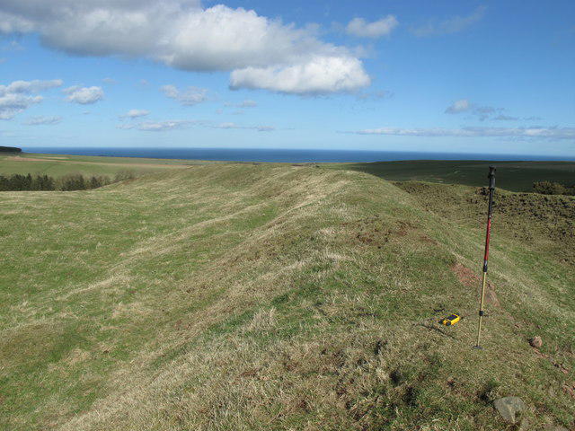 Photo could not load
NT9458 : Near Ayton Summit
Rude Health
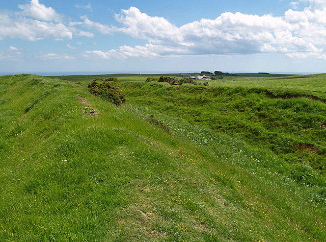 Photo could not load
NT9458 : Habchester Fort
Walter Baxter
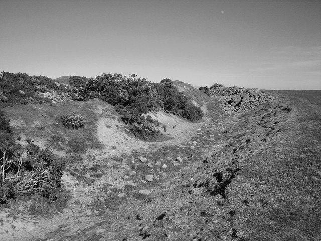 Photo could not load
NT9458 : Habchester
Richard Webb
Hill facts and local notes
Classifications
Elevation
217m
712 ft
Prominence
150m
Coordinates
55.8211, -2.0903
NT944586
OS Map
67 74 75
Explorer: 346
At the Summit
At the summit, adventurers are greeted by a modest but charming cairn and a beautiful view that can make you feel on top of the world—figuratively if not literally.
Terrain & Geology
Consisting mainly of sandstone, Lamberton Hill is indicative of the sedimentary processes that shaped much of southern Scotland. The hill offers an intriguing glimpse into the region's geological history, with exposed rock faces that tell the tale of millennia.
Views & Scenery
On a clear day, you can see the rolling hills of the Scottish Borders, the North Sea coastline, and even as far as the distant Cheviots.
History & Heritage
Name Origin
The name 'Lamberton' likely derives from 'Lamb' due to the rich sheep farming in the area, making the hill quite literally a 'sheep hill'.
Historical Significance
Historically, the area around Lamberton Hill has been inhabited for centuries, offering insight into the agricultural history of the Scottish Borders.
Getting There & Facilities
Parking
There is a small layby located off the A1 just south of Ayton, providing convenient access for hikers.
Public Transport
Bus services run to Eyemouth from larger towns, with onward connections to Ayton. However, a car is recommended for the easiest access.
Nearby Facilities
While Lamberton itself has limited facilities, the nearby town of Eyemouth offers cafes and public toilets for visitors.
Safety Information
Known Hazards
- Sudden changes in weather, particularly fog and rain, can obscure visibility. Also, be cautious of uneven ground, especially after rain.
General Safety Tips
- Check weather conditions before setting out
- Carry appropriate clothing and equipment
- Let someone know your planned route
- Take a map, compass, and GPS device
- Carry emergency supplies: food, water, first aid kit, torch
Hills
Some common questions about the hills answered
Are there group walks up Lamberton Hill [Ayton Hill]?
Many walkers use Walkmates to join or organise walks with others. You can check for group walks around Lamberton Hill [Ayton Hill] through the maps
Are there other walkers around Lamberton Hill [Ayton Hill]?
Activity varies by location and time, but Walkmates lets you see whether others have shared walks or shown interest in this area. Find other people through the walking friends search walking friends for Lamberton Hill [Ayton Hill] search or of course create your own walk for Lamberton Hill [Ayton Hill]
Can I organise a walk to Lamberton Hill [Ayton Hill]?
Yes. If there aren’t any walks listed already, you can create a walk and make it available for others to join.
If you're signed up to Walkmates, you can create a walk to Lamberton Hill [Ayton Hill].
How do I find a walk up this hill?
There are often multiple ways to walk this hill, depending on experience and route preference. Walkmates helps you explore walks and routes that others have shared.
Can I suggest a new route up Lamberton Hill [Ayton Hill]?
Yes. You can suggest or create routes to share with others. Walkmates focuses on the social side of walking, so routes are used to help people organise walks and explore areas together, rather than as detailed navigation tools or route libraries.
Other uses really appreciate knowledgeable walkers sharing their routes. Share your favourite route to Lamberton Hill [Ayton Hill] here
The is an error or something incorrect about this hill. How do I let you know?
We always strive to keep the information on Walkmates as accurate as possible. If you find an error, please let us know through the contact form and we'll aim to correct it as quickly as possible
Community Discussion
Comments
Location
View the hill's mapped position and surrounding paths.
Grid reference: NT944586
View on OpenStreetMapOpens a map in a new tab, centred on the hill.





No comments yet. Be the first.